In detail
What we are asking for, and why
Nine things the City should settle before it votes. Each section says what we are asking for, why, and what the file shows. The short version is on the case page.
The developer can pay for independent review
The developer commissioned and paid for the traffic study, the geotechnical report, the wildfire plan and the wildlife survey in this file.
Lone Tree’s own code lets the City hire independent experts and send the developer the bill. That is Municipal Code § 16-1-60(a) and § 16-2-140. The City has not used that authority on the questions below.
01 · Life safety
Show that people can get out before approving 343 homes behind one road
An independent evacuation model would show whether people can get out. The file does not contain one, and the City can require it before it decides.
Engineers call it an evacuation time estimate. It loads the road network in simulation software with the households who would leave at once and reports how long clearing them takes. Transportation consultants do this work under contract with a defined scope and schedule, so the City can require it without an open-ended delay. What that means
In a fire, 343 new households and the neighborhoods already below the mesa would use the same roads at the same time.
They all reach the same I-25 ramp. The developer’s own engineer records a turn there that already fails in the evening rush, before this project exists.
One public road serves the subdivision, with two backup gates for fire trucks. One goes west onto McArthur Drive. One goes south onto North Heather Drive. Both end on county roads outside the city.
The fire code sets two fire-apparatus access roads as the default above 30 dwelling units, with an exception where each dwelling is fully sprinklered. Lone Tree adopted that appendix in 2018, so it applies here. We expect the developer to rely on the sprinkler exception. Sprinklers protect people inside a house. They do nothing for the roads a family needs to evacuate.
That provision governs fire engine access. It does not address whether 343 households and the neighborhoods below them can evacuate at the same time, and the City has not asked anyone to study that.
The developer has explained in writing why one of those gates cannot carry a public road.
“The majority of the McArthur Drive emergency access will be +/-10%, which meets emergency access criteria, but is much steeper than the 6% allowed for a public roadway. Because of this elevation difference, a public roadway connection is infeasible at this location.” Community Response Letter, March 27, 2026
South Metro Fire Rescue’s comment letter was conditional. The application does not model what happens when Hillcamp and the neighborhoods below it leave at the same time, and the City can require that before it decides. The developer’s filings
02 · Water
Find the water first, and study what this does to the wells below
The properties below this site rely on private wells and the water rights that came with the land.
State law says a local government shall not approve a development like this without first finding the water supply adequate. That finding is not in the file. The City’s own code asks for evidence that adequate water supply is available at preliminary plan, which is Municipal Code § 17-3-70(4). What the code does not set out is a procedure or a standard for making the determination the statute requires.
The will-serve letter the project relies on is missing three of the six things state law asks of one.
The project regrades a mesa top. It builds detention ponds and drainage works to route stormwater away from the slopes. The applicant’s own drainage engineer says sending it over them would create unstable conditions. The water those works capture is water that no longer soaks into the ground above our wells. The drainage memorandum does not contain the words groundwater, aquifer, recharge or well.
No one has delineated the wetlands
The same drainages feed wet ground below the mesa. That ground holds water through a dry summer and supports wildlife.
The applicant’s biological assessment reports that it “did not observe obvious evidence of wetlands as defined by the Corps on or adjacent to the Subject Property.” That is an observation from one site visit on August 29, 2023. The Corps’ own test asks for hydrology, soil and vegetation indicators together. The report describes that test but does not apply it. A formal delineation would settle it. The City can ask for one, and for a study of what the new grading and detention do to the water reaching that ground.
“is not a promise or guarantee that Parker Water will provide water and wastewater services to the development” Parker Water District Manager, to the district board, December 11, 2025
03 · Geology
Finish the ground studies and accept them before approving the road
The road climbs mapped landslide ground above existing homes.
The Colorado Geological Survey has reviewed the road several times. In January 2026 it told the City the investigation was not enough.
“From a geologic hazard perspective, the current level of investigation is insufficient to support approval without additional studies.” Colorado Geological Survey, January 30, 2026, as quoted in the applicant’s Geotechnical Response Letter
The developer revised its analysis. The Survey’s August 20, 2026 letter no longer objects to the plat. It also says the study “remains preliminary,” was based on older construction plans than the ones now filed, and “does not fully address” its concern about how much weakened, previously moved ground was modeled. In one section the critical failure surface does not appear to reach the weak zone. The Survey asked that the final plans require inspection and maintenance of slopes, drainage and sub-fill drains for the life of the road.
City staff required a final report, not a preliminary one, before plat approval and a minimum factor of safety of 1.5. The September 4, 2026 report still says “The recommendations provided are preliminary,” says 1.3 is acceptable, and shows Sections B-B and F-F below 1.5 before and during construction. The safety numbers improved between rounds because the analysis assumptions changed. Nothing on the hillside changed.
The maintenance plan filed in September 2026 schedules mowing twice a year, trash and sediment removal, and an annual check for erosion. The October hearing packet
04 · Traffic
Redo the traffic study against the roads people would use
Our roads are narrow rural roads, and emergency traffic from every neighborhood here ends up at the same interstate.
On the developer’s own numbers a turn at the I-25 ramp already runs at the worst grade traffic engineers give. That is in the evening rush, before this project exists. The proposed fix is retimed signals, which CDOT controls, not the developer.
The project’s own study projects 3,136 vehicles a day and routes them north to RidgeGate Parkway. In an emergency, that changes. If the City counts the gates as a way out, those cars reach roads the developer’s own wildfire consultant rates at 400 a day. The study does not model it.
Between January 2025 and September 2026 a single incident closed I-25 in Douglas County in at least one direction at least ten times, by our own count. Four of those were fatal. One of the underpasses this neighborhood would evacuate through does not appear in the study at all.
05 · Wildlife
Require a new wildlife survey before deciding
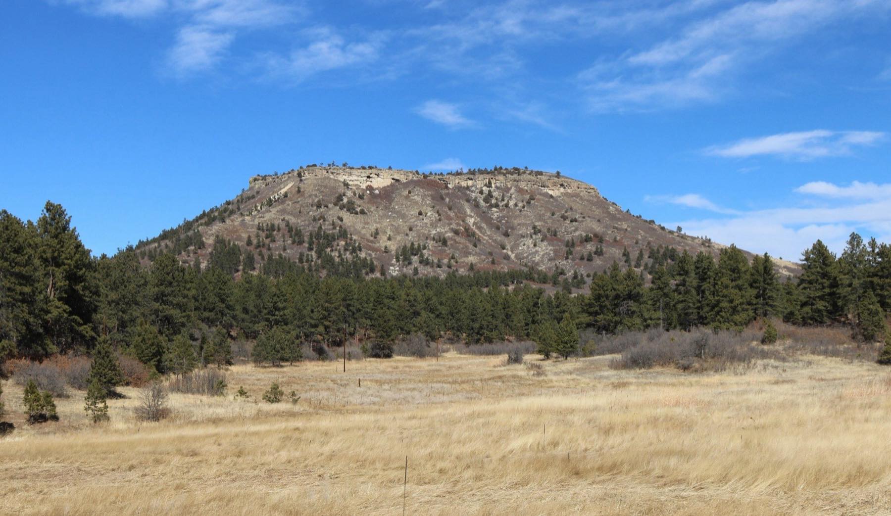
Wildlife pushed out by recent building elsewhere in RidgeGate now uses this ground.
Colorado Parks and Wildlife maps a Big Game Pinch Point on this property, a place where animal movement is funneled or constrained. The applicant’s own consultant wrote CPW’s recommendation into the file and the application went ahead.
The survey behind it is a single visit made on August 29, 2023. Elk rut here from about mid-September into October, and that is when a large herd is most visible and most tied to one piece of ground. An August visit falls before it. A survey over a full season would show which animals use this land and when.
Since that visit RidgeGate East has added roughly 900 homes and units, with about 1,700 more planned, plus the City’s Justice Center, an 80-acre park and a school. That does not appear in the wildlife analysis.
“CPW recommend No Surface Occupancy and No Ground Development in Big Game Pinch Pont [sic] Areas” Wildlife Preservation Plan, CTL Thompson, submitted with Resubmittal 2
A new survey should run a full season, paid for by the developer and carried out by someone the City picks. The wildlife plan
06 · Timing
Answer the questions before the vote
The answers could move lot lines and houses, so the plan neighbors are commenting on may not be the plan that gets built.
The road’s own ground study is still preliminary, and City staff have written that some lots or other improvement areas may need to be removed once the extra slope analysis is done.
Height variances, lot-by-lot ground review, landslide mitigation, wildfire maintenance, traffic and wildlife are all left to a development agreement that is not in the file.
City Council minutes for June 16, 2026 record an executive session to instruct negotiators on that agreement. A session of that kind is lawful, but the agreement itself has not been made public.
Colorado law requires the water finding before approval. What the law requires
07 · Cost and representation
Build the second access inside Lone Tree
The households who would carry the impacts cannot pay to fix them.
Surrey Ridge has no district with power to levy or to issue bonds. We checked the state list and found none. Nobody here can fund hydrants, a wider road or a shoulder. Hillcamp’s side of the line has nine districts, and one of them is building its infrastructure.
Our streets were platted in the 1960s for large rural lots. Douglas County has authority over these roads, and we have not found a filing from it in the record.
The developer’s own engineers looked at seven routes up the mesa in a November 20, 2025 memo to the City. Two inside Lone Tree, the old ranch road the Retreat HOA suggested and a route from behind the Cabela’s center, met the criteria for emergency access. The developer did not take either one forward.
Lone Tree can build the second public access inside its own limits. That side is steeper and costs more. The current plan shifts evacuation traffic, fire exposure and possible effects on our wells onto a neighborhood outside the city. The application does not address that.
08 · Land use
Show the work against the City’s own plan, and talk to the neighbors it promised to consult
Matching the Comprehensive Plan is a condition of approval, and the file does not contain an analysis of that match.
That plan calls this area the Residential Plateau and describes the bluffs as a prominent natural land form of regional significance. One of its objectives for this area reads,
“Afford opportunities for review and comment of proposed development to adjoining communities in and outside Lone Tree’s jurisdiction.” Lone Tree Elevated, Residential Plateau, Land Use Potential
We are the adjoining community outside the jurisdiction, and we were not notified. In the Rural Residential area the plan asks for exactly the 261 units the zoning caps it at. One more would force a rezoning, and the mailed notice that comes with it. The plan and the code
09 · City and developer
Hire independent experts and send the developer the bill
The applicant paid for the studies the City would rely on, and the City’s code already lets it hire its own.
RidgeGate is a single master-planned development of roughly 3,500 acres. Lone Tree is about 6,278 acres.
Coventry Development donated the six acres under the Lone Tree Arts Center, valued at $3 million. It also donated the land that now holds the Justice Center and the Public Works facility. In 2020 the developer’s metropolitan district conveyed 374 acres of open space and 18 acres of parks to the City for $25.
In September 2026 the Lone Tree police department and municipal court moved into the Justice Center in RidgeGate East. On the City’s own description a second recreation center and a second library are planned for the same district.
All of this is public record, and Lone Tree has benefited from it. We raise it because the City is weighing studies paid for by the same party, and its code lets it commission independent ones. The source documents
Read it yourself
Each point above comes from a document the City or the applicant filed. The documents page lists and links them, with plain definitions of the common terms.